
This map shows the schools, emergency and medical centers located in a coastal flood prone area. There are 42 facilities at risk.
This map illastrates the relation between water depth and the population of Collier County. The water depth is consistnely 16.5 ft throughout the caterogy 3 storm surge area.
These are screenshots from my Pandemic 2 game. I should have focused more on faster killing and developing against cold.
I tried to put a lot of focus on keeping the virus heat and moisture resistant but still most of South America, Africa and Australia stayed pretty healthy. Maybe I should have gone after the symptoms more to spread it more quickly.
Once I infected Peru, I expected it to spread but it didn’t. I’m still not sure why.
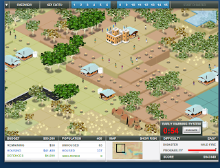
Create a disaster images:
These are my images from my fire and tsunami event. I tried to kill during the tsunami once but failed on my attempts to save but was successful on my attempts to kill.
The map below demonstrated the facilities that would be at risk to a flood.
The map below deomstrates how high the strom surge would reach if a hurricane would hit Collier Country. The maps below demonstrate what the floodplain of Eau Claire is. The area I focued on is the university and "student ghetto" area, or Water Street to First Street. The first is 780ft, the second 790ft and the first 800ft.
These are images from our Mount St. Helens lab assignment. We looked at the slope and lahar pathes. We also looked at imagesto compare the mountain before and after blast and the total volume loss.


No comments:
Post a Comment